
Travel Plan - Mumbai - Pen - Sandoshi / Kewle
Distance - 600 km covered to and fro
Time - 7 hrs one way approx.
Commute - By Public Transport / Car
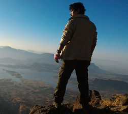
This fort is on the boundary of Raigad and Pune district. It is located at the edge of the Kawlya ghat from where you can see the lit villages of Konkan. The two popular routes to the fort are a walk from the village of Ghol and a climb up the Kawlya ghat from the nearby Bawlya-Kawlya villages.
The Konkan Diva Fort was built to guard any invasion through the Ghol village along the Mutha River. The Konkan Diva Fort was built as a watch tower for the capital city of Raigad. Lets explore with Crazy Els.
Travel Plan - Mumbai - Nashik - Vani
Distance - 320 km covered to and fro.
Time - 6 hrs one way approx.
Commute - By Car
Fort AHIVANT is a part of Ajanta mountain range. Ahivant and Achala are neighbors. Ahivant Fort is a fort located 55 km from Nashik, in Nashik district, of Maharashtra. On the north of Saptashringi and to the west of Dhodap fort, is situated this fort with a big plateau.
Travel Plan - Mumbai - Kasara - Harshewadi
Distance - 320 km covered to and fro.
Time - 6 hrs one way approx.
Commute - By Public Transport
Harihar fort is located in the Nashik district of Maharashtra. It lies at an altitude of 3,676 ft from sea level.
The hill on which the fort is built looks like a rectangular shape from the base village. But it is built on the triangular prism of rock from the Yadava dynasty. The edges of the Harihar fort are almost vertical.
The attraction of Harihar fort is the iconic steps to the top of the fort. It is almost 80 degrees vertically inclined.